Directions to and from His Wings Ranch
Crossing the border South – As of Feb 2026 the giant overpass was open. To reach it take the first right after you cross the border. You’ll go up a steep ramp on the right side that turns 180 degrees way up over the concrete culvert below. It will send you west to the toll road. When you see the water you’ll take the left two lanes to connect to the toll road rather than going to “Playas de Tijuana”

Here is a map of the entire 2 hour drive down from the border using the blue toll road on the ocean. (You’ll need about $2.50 for each of the 3 tolls)
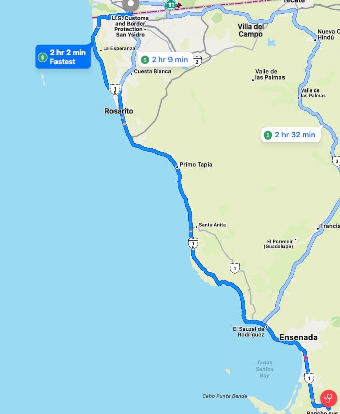
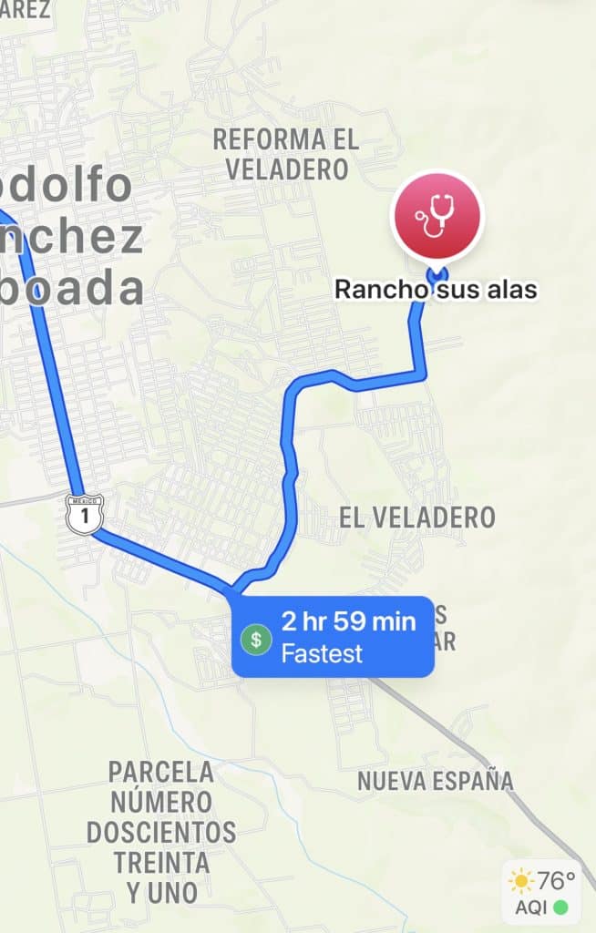
There are two sets of maps from here. This first set shows a high level overview (Disregard the times written on the map). The second are arial looking down at the reality of Baja dirt roads.
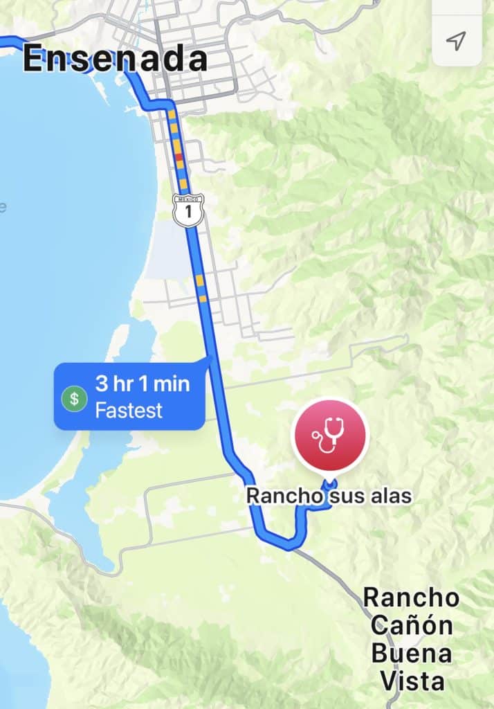
Here is close up of where you turn left. (east)
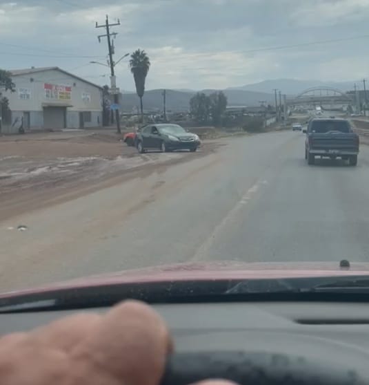
Here is a close up of the warehouse where you turn left from highway 1 and drive along the North side of the warehouse. (Before the warehouse)
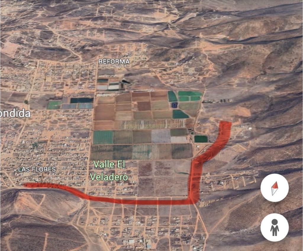
Here is a close up of the first leg after turning from highway 1. Contrary to the Google image, it is not a pretty signed road in real life.
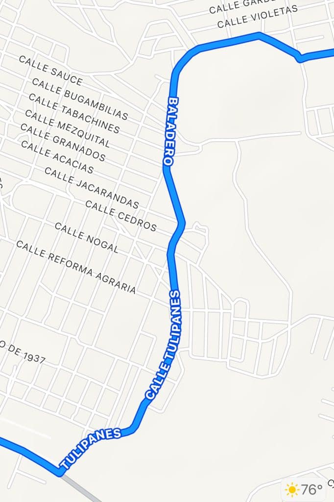
Here is the second half
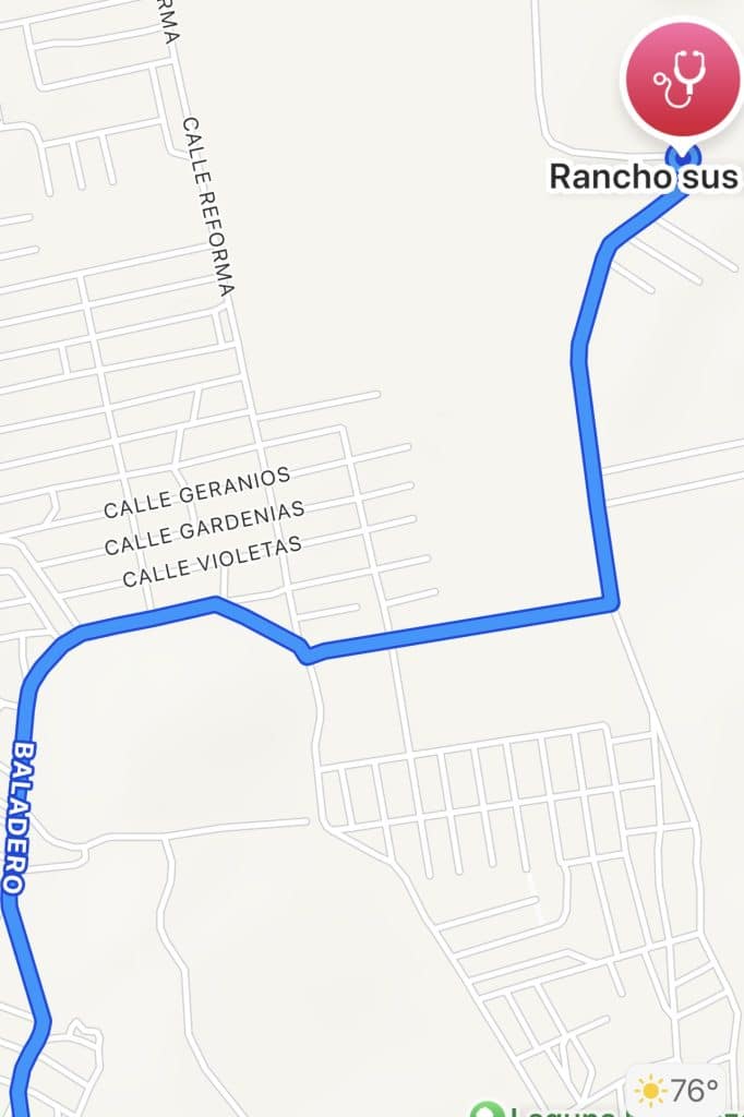
Now that you’ve seen the sanitized version, here is what it actually looks like. Note that the road goes from dirty pavement to just dirt at the top of the image where it crosses north of the hill
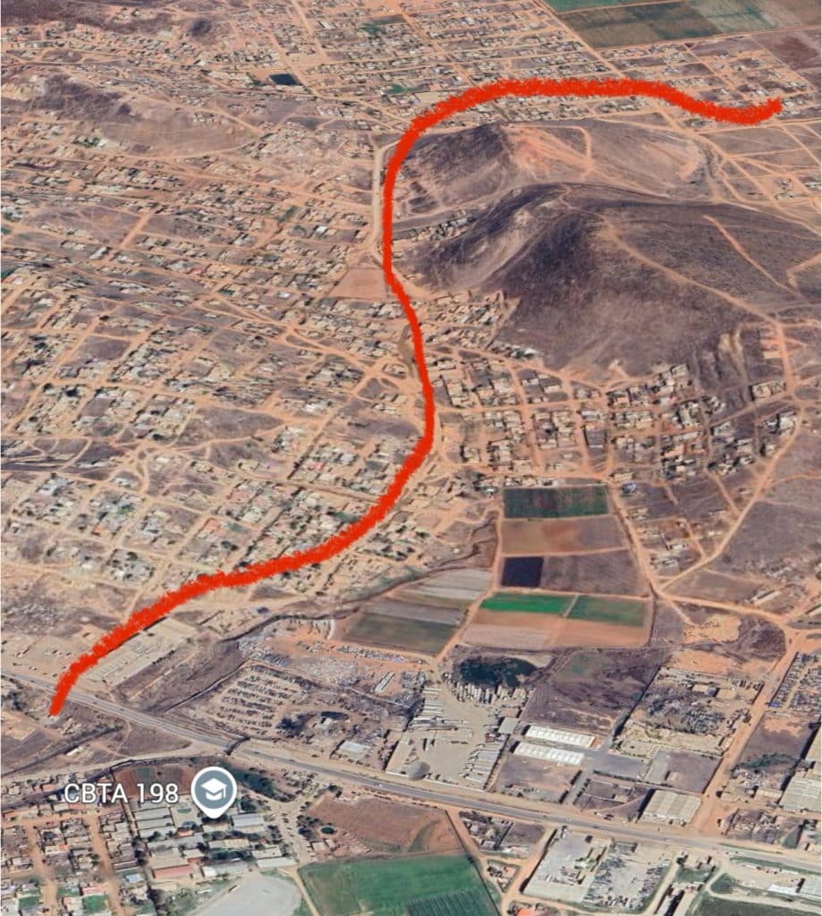
Below is a more accurate tracing of the path just north of the hill. You’ll veer right at the triangular area in the image below. If you see a burning pile of trash on your right, you are in the right area. (Welcome to Baja!) When you reach the end of the triangle you’ll veer slightly left as shown tow images below. (Note that the red line is sloppy at the right side and goes off the road )
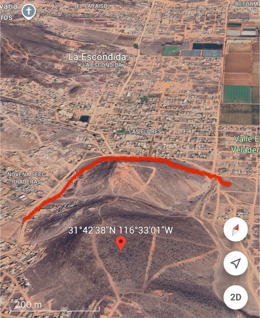
The slight left you just veered at puts you on the road that follows along the south side of the fence bordering farm land on your left (North).
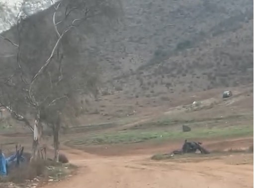
You’ll “T” into another dirt road and turn left past the tree to head north with the fenced farm on your left.
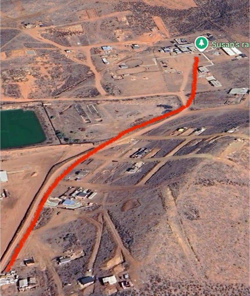
The road will veer right as on the map but you won’t notice. The Ranch is straight up the road. You made it! (No longer follow the road because it takes a hard left.)
You’ll see a double gate in front of you. That’s His Wings Ranch!
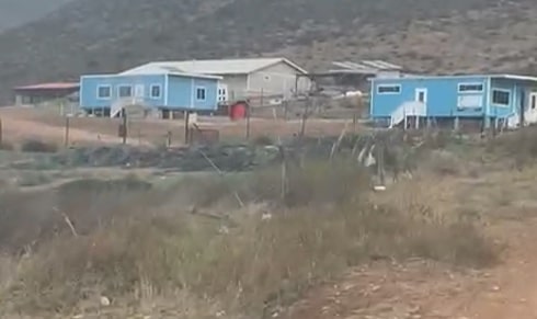
Here is what His Wings Ranch looks like as you drive up. Multiple blue portable buildings. You Made it!
Traveling North Across the border if you have Sentri
If you’re not sure if you have Sentri then you don’t have it. Sentri requires a fee, interview and long wait to get the coveted card. Without Sentri you might consider crossing at the Otay Mesa Crossing. Here’s more for regular border crossers. Be careful, routes change!
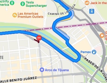
- For Sentri crossing: Start by going to the Hotel Lucerna and access the roundabout there.
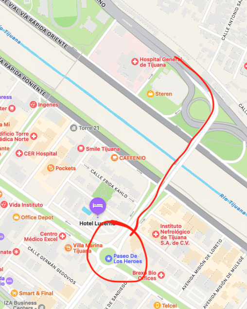
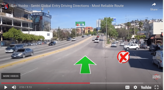
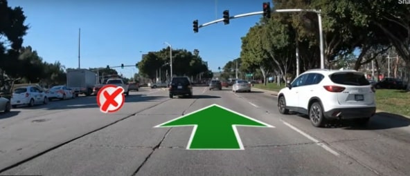
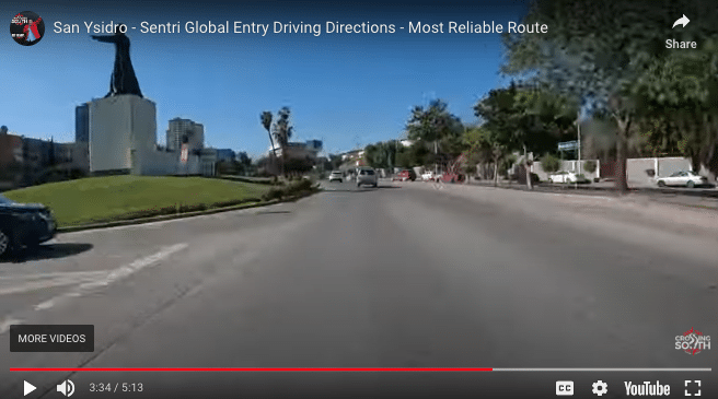
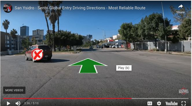
Both your phone map and the signs will indicate that it’s fastest to vear left. DON’T DO IT. There is an illegal turn with ticketing police waiting for those who make this error. Instead stay on the Red Line on the map below.

Stay in the middle two lanes which will be bordered by concrete on both sides. (They prevent line cutters! )
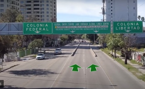
It’s smooth sailing from here. You’ll past one last stop sign where on first glance it looks like others could cut into the line in front of you only you’ll also notice a bunch of police ready to ticket them if they do. Aren’t you glad you didn’t accidentally take that route!
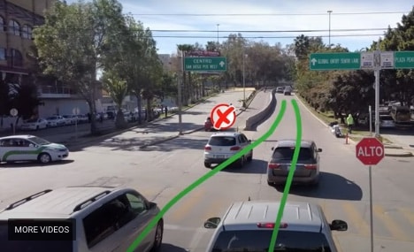
You are now locked into the Sentri lane system. Any lane you select from here through the border is just fine. Welcome home! And if you have a person in your car who does not have global entry you can let them out here a quarter mile past the stop sign in the last photo. They can get out anywhere around this bridge. You’ll be stopped in line so not a big deal to get out.
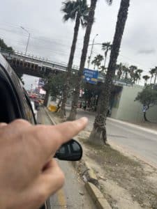
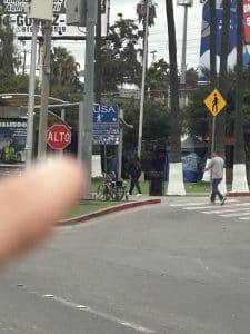
Follow the many people walking to the right of the lane of traffic you just stepped away from. There is even a blue “USA” sign to help guide you.
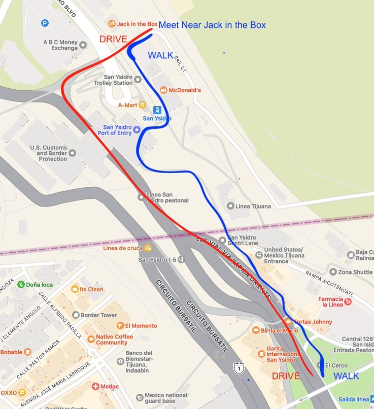
Meet at the Jack in the Box just north of the border.
Drivers take an immediate right after driving over the tire destroying bumps (San Ysidro Exit).
Walkers meet across the street from Jack in the box (south side) so your driver can pull over pick you up then do a uturn to get back on Hwy 5 north.
